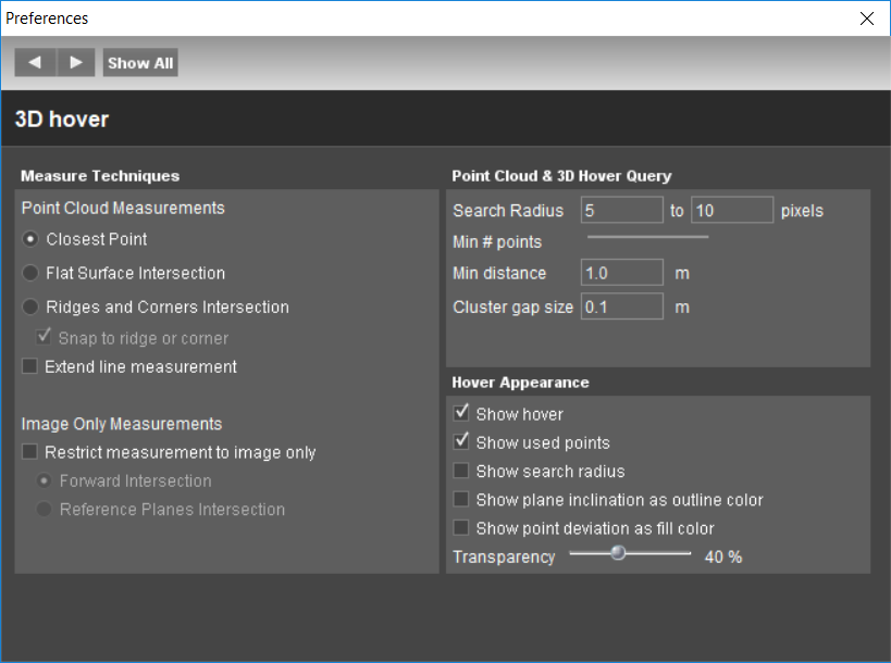
Point Cloud Measurements
The goal of this exercise is to demonstrate to the user how to measure objects using the point cloud of a run. The user will be able to perform measurements using different techniques: “Closest Point”, “Flat Surface Intersection” and “Ridges and Corners Intersection”, as well as save the results in a vector dataset.
- Relevant for : 3DM Feature Extraction, 3DM Content Manager, 3DM Publisher
- Product use for recording : 3DM Feature Extraction Standard 18.1.1
Preparations
Reference documentation
Preceding Exercises
Resources
- CA Toronto\MMS Orbit Runs
Exercise
Extract objects using different techniques.
- Add run
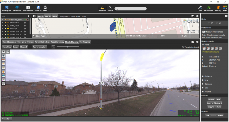
Add the run CA Toronto by Optech. - Measurements
Measure one pole using “Closest Point” technique, choose “Point Height to ground” tool. - Measurements
Measure one pole using “Flat Surface Intersection” technique, choose “Point drop to Ground” tool. - Measurements
Measure one side of the road using “Ridges and Corners Intersection” technique and choose for the “Free Line” tool.
Results