Getting started with QGIS Plugin
The goal of this exercise is to demonstrate to the user how to use the QGis Plugin, to connect to a publication and use the available tools for viewing, navigation and measuring.
Relevant for : 3DM Publisher
Preparations
Reference documentation
Preceding Exercises
Resources
- demo.optech.maverick, from https://demo.orbitgt.com/3d_mapping
Exercise
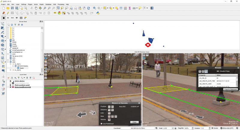
Overlay vectors, select objects and perform imagery and point cloud measurements.
- Connect to the demonstrator
Url: https://demo.orbitgt.com/3d_mapping. - Load publication
Choose the publication demo.optech.maverick. - Overlay vectors
Overlay the available vectors on the MM images. - Selection
Select one object and display its attributes. - Measurements
Measure one area on the imagery, and save it in an QGis layer. - Measurements
Measure one area using the pointcloud, and save it in an QGis layer.
Results
Last modified:: 2019/03/25 11:36