Getting started with the MM ArcGIS Plugin
The goal of this exercise is to demonstrate to the user how to use the ArcGis Plugin, to connect to a publication and use the available tools for viewing, navigation and measuring.
- Relevant for : ArcGIS plugin
Preparations
Reference documentation
Preceding Exercises
Resources
- demo.optech.maverick, from https://demo.orbitgt.com/3d_mapping
Exercise
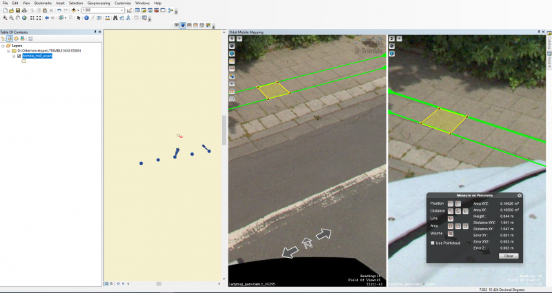
Connect to the Orbit Demonstrator, Load publication, display point cloud. Measure and save the results, visualize metadata.
- Connect to the Orbit Demonstrator
- Load publication
Choose publication demo.trimble.mx8.essen_4326. - Overlay point cloud
Display the overlaid pointcloud on the imagery. - Measurements
Measure two areas, one using triangulation and one using the pointcloud. - Copy measurements
Save the measured areas as objects in ArcGIS. - Show metadata
Display the metadata for the currently opened panorama.
Results
Last modified:: 2019/03/25 11:36