Table of Contents
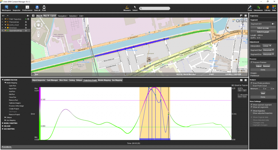
Trajectory
The goal of this exercise is to demonstrate to the user how to adjust imagery, pointcloud and trajectory data based on GCPs measured in the previous exercise.
Relevant for: 3DM Content Manager
Preparations
Reference documentation
Preceding Exercises
Resources
- BE Gent\MMS Orbit Runs
- BE Gent\Ground Control Points
Exercise
Adjust the trajectory by using ground control points.
- Open the run
BE Gent by Topcon. - Open the Trajectory extension.
- Create a new segment
by selecting on the Map a segment around the the measured GCPs. - Adjust the data
using “Linear” interpolation method, and using “Interpolate” at segment start and end. - Process a preview.
- Check the result
of the adjustment preview.
Results