Table of Contents
Create New Dataset
To create a new dataset, the new dataset wizard has to be used.

- At least one dataset has to be open to determine any reference to a coordinate system or a coordinate system has to be assigned to the dataset (??)
- Only one model will be defined in this new dataset. After finishing the wizard, it is possible to modify the dataset structure and properties.
New Dataset Wizard
- Enter a name for the new dataset. This name will be used in the dataset list.

- Select the spatial data type: point, line or area.
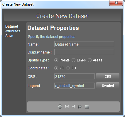
-
- Click
 to add an additional attribute, select an attribute in the list and click
  to remove an attribute.
 - If there is no attribute name entered, the attribute will not be added.
- After entering all attributes and specifying their data types, finish the wizard and save the new dataset by clicking
 .
.

- Specify the location and enter a name for the dataset.

- The new dataset will appear on top of the dataset list.
- It is now possible to modify the dataset structure (add a model, add an attribute set, specify rules, etc.)
- To create and add objects for this new dataset, use the edit tools sidebar.
