Table of Contents
Datasets & Workspaces
In order to publish geodata (vector, raster, image), this data needs to be available by the EOS server and organized in Workspaces :
- Add your data to the EOS server
EOS Console > Resources > Datasets
Resources > Datasets > Dataset Setup - Organize and combine datasets into Workspaces
EOS Console > Users and Permisssions > Workspaces
Workspaces
Remarks
- Only datasets with a defined coordinate system will be published correctly.
Coordinate Reference Systems in Orbit
Dataset General Properties - Only the first model of a multi model dataset will be available for overlaying on panoramas.
Vector dataset structure concepts
Dataset Structure
How to add a new dataset to an existing workspace
1. Place your new dataset to the desired folder on the server
Example: Orbit\server\data\datasets\ortho
2. Add to Orbit EOS
Open the Eosconsole
(http://serverIP:1111/eosconsole/index.htm).
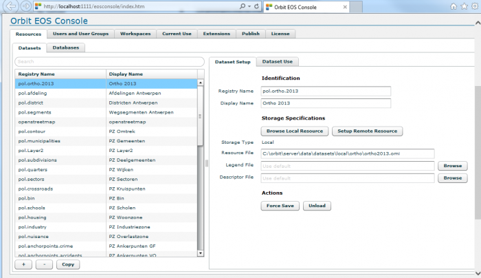
Add the new dataset to the tab Resources:
For example:
- ortho2013.omi (registry name: pol.ortho.2013, display name: Ortho 2013)
- Browse to the resource
3. Add to Workspace
Next you determine in which workspace this new dataset must be available/visible.
Choose a workspace:
a) Go to the tab 'Users and Permissions'.
b) Tab 'Workspaces'
c) Choose in the tab 'Resources' the desired 'datasetlist' and click onto +

d) Add the new dataset by double-clicking onto the chosen name.
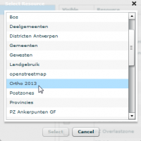
You can change the order of the datasetlist by dragging the dataset. Put a raster image (example: ortho, streetmap) at the bottom of the datasetlist (otherwise the raster image will cover the vector layers completely).
For more detailed information about the Eosconsole click here.