For documentation on the current version, please check Knowledge Base.
GPS Photo Locator
The GPS Photo Locator allows to :
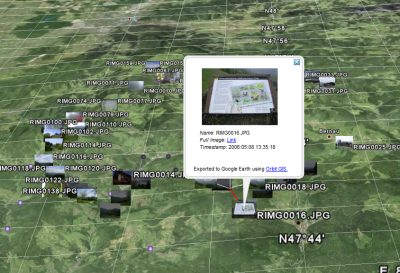
- Explore GPS-tagged photos in Google Earth without publishing them to an on-line service.
- Export images to the Google Earth KMZ-format
- Export images to any GIS system that supports the Shape format
Availability
The Photo Locator application is available in 2 forms :
- Photo Locator Standalone : Standalone application.
- Photo Locator Extension : Requires Orbit GIS or Orbit Explorer Plus to operate, adds interactive geocoding and GIS integration.
Download
The Photo Locator can no longer be downloaded.
Instruction Movies
- Orbit GIS import & Google Earth export of GPS tagged photos
- Localization and orientation of non GPS tagged photos
Using the Photo Locator Orbit GIS extension
Settings
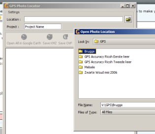
Location
Select the directory containing the photographs.
Project
Enter a project name :
- When importing in Orbit GIS in a new dataset
the project name wil be given to the dataset username and added as an attribute value. - When adding in Orbit GIS to an existing dataset (points)
the project name will be added as an attribute value to the imported photos. - When exporting to Google Earth
the project name will be configured as the name of the placemark file. - When exporting to shape file
the project name will be added as an attribute to each object
Dataset
In this dataset combobox there is the choice between :
- creating a new standard GPS Photo dataset.
- selecting an in the current workspace opened point-based dataset.
Link with map
Use this option to automatically select and highlight imported photos by clicking them in the GPS Photo Locator extension.
I've uploaded the images to a website
Use this option to enter the url where the photos were uploaded. When there is given a correct url, it wil be possible to use the full image link in Google Earth or Maps.
Functions
Import photos in Orbit GIS
There are to possibilities to import GPS tagged photos :
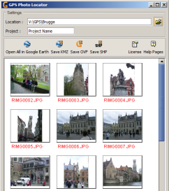
- Import all photos : Click the import all button in the toolbar
- Import a single photo : Right click the thumbnail and choose “Import photo” or click the single import button in the toolbar.
Set view projection
When combining datasets with different map projections make sure that all dataset projections are correctly defined.
The created dataset as result of a GPS photo import is always and automatically set as World WGS84, the coordinate reference system of each gps application. Make sure that the coordinate system of the Orbit GIS View, the georeferenced context, is correctly defined.
- Set Orbit GIS view projection, see Map View Window
- More information about projections, see Wikipedia - Map Projection
- More information about World WGS84 GPS projection, see Wikipedia - World Geodetic System
RICOH Memo attributes
Orbit Photo Locator can also integrate RICOH Memo attributes into the exported shape file. Make sure the .MTA file (defining the attributes) is present in the same photo directory when importing the GPS photos.
- More information about the RICOH 500SE camera, see User Manual
- More information about use and tools of memo functions, see cd-rom Caplio Software Operation Manual.
Open photos in Google Earth
- Open all photos : Click the Google Earth export all button in the toolbar
- Open a single photo : Right click the thumbnail and choose “Preview in Google Earth”
Export photos to a Google Earth KMZ-file
- For more information about the KMZ-file. See Wikipedia KMZ file
- An on-line kmz-file can be viewed in Google Maps by filling in the URL to the KMZ-file as Google Maps search location.
For example : Monuments of Bruges


