For documentation on the current version, please check Knowledge Base.
Orbit MM Plugin for QGIS (Flash)
The Orbit 3D Mapping Publisher makes it possible to use Mobile Mapping, Oblique, UAS, Indoor or Terrestrial content within Qgis.
This page describes the use of the Orbit 3D Mapping Plugin for QGIS.
Orbit Mobile Mapping Toolbar

Display Orbit Toolbar
Enable or Hide the Orbit Toolbar via QGIS Plugin Manager :
Top Menu > Plugins > Manage and Install Plugins… > Orbit MM for QGIS
Buttons from left to right
Show Photo Positions on Map
Display the photo positions on the Map Frame.
Photo positions are displayed as individual points at Map Scale >= 1/2,500. If the Map Scale is < 1/2,500 and >= 1/50,000 a simplified line representation will be used. Photo positions are not displayed at Map Scale < 1/50,000.
Open Image from Map
Open or update the first Image View.
Activate the function and click on the Map Frame to open the closest image.
Photo positions do not need to be visible to open an image.
Save Measurement as Feature
Save a completed measurement as feature in an available layer. Only layers with corresponding spatial type (point, line, area) will be listed as target layer.
Manage Overlays
Overlay an available layer in the Orbit MM Component.
Show Login Screen
Connect to an Orbit MM Publisher and open a Publication.
Set “Remember my login” and “Auto login next time” to facilitate future access.
Help
Go for help. You will be redirect to this page.
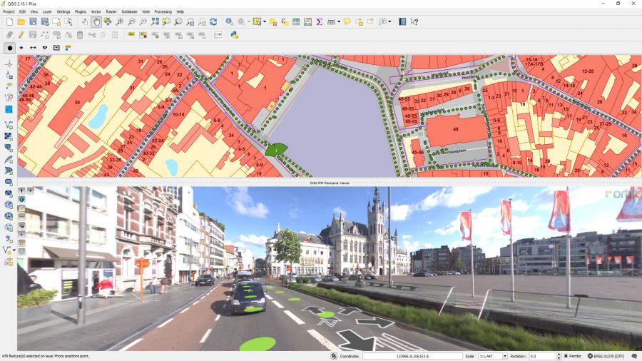
Map Component
The Orbit Mobile Mapping component is fully integrated in QGIS :
- To use the Map component we trust on your knowledge of QGIS.
- To open an photo or to load the photo positions a georeferenced Map Frame is required. Load a reference base-map or layer and zoom to the area of your interest.
QGIS Map rendering might slow down when displaying the Photo Positions.
To overcome the reduced QGIS Map performance, we advise (1) to set photo positions invisible, (2) to set the same CRS for both QGIS Map and the Orbit Publication, and (3) to limit the amount of MM Data shared and added to QGIS via the Orbit Publication.
Photo positions do not need to be visible on the Map to open an image in the Orbit Mobile Mapping Component.
Panorama Component
The Orbit Panorama component is a docked QGIS component, in the bottom part of the screen.
The documentation on how to use the Orbit Panorama component can be reviewed here : Mobile Mapping View Component.