For documentation on the current version, please check Knowledge Base.
Annotations Overview
This page describes the general operations and principles of Annotations.
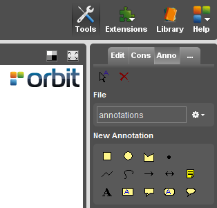
More information about all features of the Annotation Tools Sidebar, see: Annotation Tools Sidebar.
What are annotations ?
Annotations are tools to complement the map data with temporary notes or sketches. Orbit provides a range of annotation types that can be stored in an annotation file or as attribute (only in OVF format). Since Orbit annotations are georeferenced, they remember exact positions and can be exchanged with colleges.
Annotations structure
An Annotation consists out of some Annotation Objects. An Annotation Object is a rectangle, a line, a text (See annotation types).
An Annotation can be temporary, can be stored in a file, or can be stored as attribute to a spatial object (See Dataset Structure - Naming).
Exchanging Annotations
Since annotations are georeferenced, you can easily exchange your remarks with a colleague. Just save the annotation in a file, and email the *.oaf file. Your colleague can open this file using the Open Annotation File function.
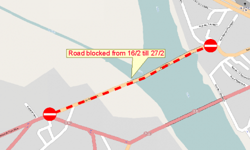
Example