For documentation on the current version, please check Knowledge Base.
Great Topics about Orbit Tools
This page publishes 4 headlines about the Orbit Tools you should know as an Orbit user. It gives a closer look to some important viewpoints of the Orbit Tools.
Wich aspects of editing, building constructions and annotations do we need to pay attention to?
1. Let there be Points, Lines and Areas!
Create objects with the Edit Tools: Either Points, Lines or Areas.

Objects can be used to represent topographic data on the map:

| Points | Lines | Areas |
|---|---|---|
 | 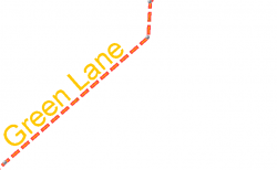 |  |
| For Example: Adresses, GPS photo positions, .. | For Example: Streets, train lines, .. | For Example: Buildings, Parcels, Contours, .. |
Every object has a unique Set of Attributes that can be edited in the object inspector. (Information that is essential for the object itself.)
Example:
| Adresses | Roads | Parcels |
 |  |  |
2. Constructions vs. Objects
Do not confuse Objects with Construction points or lines!!
These tools have a completely different use and structure:
| Constructions | Objects | |
|---|---|---|
| Example |  | |
| Types | Construction Points Construction Lines | Points Lines Areas |
| Attributes | No Attribute Component | Each Object contains a Set of Attributes |
| Storage | Stored in a Construction File (*.ocf) that can only be opened within the Construction Tools Sidebar | Saved in the dataset |
| Use | Used to draw Objects on | Used to put essential geographic information on the map. Each Objects contains its own information. |
3. The Power of Snap!
While editing objects it's important to notice the Snap Function!

Snap is the action which fits a vertex of an object into the position of a nearby vertex or a Construction Point or Line.
The snap indicator shows a red circle in case of a snapped vertex.
Snappable positions
The Snappable positions on the map depend on the Editing Preferences.
| Possible positions to snap while editing | |
|---|---|
| Vertices of selected objects only | 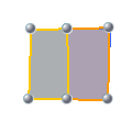 |
| Vertices of objects within the activated dataset | 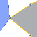 |
| Vertices of all visible objects | |
| Construction Points |  |
| Construction Lines |  |
4. Note my Annotation!
Use Annotations to share temporary detailed information with your colleagues.
Combine Free Text with spatial figures to clarify your information on the map. Mail the annotation file (*.oaf) to your colleagues, they can open it in their own Orbit.
For example a temporary traffic obstruction:
