This is documentation of an archived release.
For documentation on the current version, please check Knowledge Base.
For documentation on the current version, please check Knowledge Base.
Orbit UAS Mapping
|
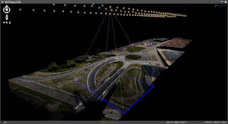
Orbit UAS Mapping Software is bundled with Orbit GIS and provides the tools to create automatically and start a high precision mapping from scratch or based on generic UAS aerial imagery. End-products are orthophoto, stereoproject, 3D point cloud, contour lines, volume calculations, 2D/3D vector mapping, GIS management. The software supports all UAS systems, i.e. fixed-wings as well as multicopters. Be aware to use the correct import data. Be aware that for this photogrammetric process to high-accurate, absolute-orientated mapping data, there are requirements such as calibration of the camera, fixed ground control points, and positional information of the imagery.
|
Must haves before postprocessing start:
be sure to have the imagery, a calibration report of your camera, an external orientation file, and a set of ground control points.
| Imagery: | Any supported image file (jpeg, jp2, omi, bmp, ecw, gif, png, tiff, … ) can be used. Default format for direct import is *.jpg or *.tif. |
| External Orientation: | All imagery needs to be properly documented in a photolist linked with Name and the X, Y, Z, pitch, roll, yaw orientations. |
| Calibrated Camera: | Camera calibration is the process of estimating the internal parameters of the camera that deal with the camera's internal characteristics, such as, its focal length, sensor size, pixel resolution, and image center. Knowing intrinsic parameters is an essential first step for postprocessing your aerial data to high-accurate 3D maps. It removes lens distortion, which degraces accuracy. |
| Ground Control Points: | Generate and measure in a file a set of ground control points (and check points). |
Orbit UAS Mapping Documentation
| General | |
|---|---|
| Supported Systems: | The software supports all UAS systems, i.e. fixed-wings as well as multicopters. Be aware to use the correct import data. |
| Generic Import Data: | The software supports fixed-wings as well as multicopters for high-precision, absolute orientated land survey and inspection mapping. Please, have a look at the specifications about the generic import flight data. |
| Tips & Tricks before Take-off: | Be aware that you take into account some neccessary flight and process conditions before take-off. Find here more information about the crucial starting stage. |
| Installation: | Download and install Orbit UAS Mapping or Orbit UAS Mapping Pro. Raise the available memory. Edit license. |
| Quick Start Tutorial: | Try out the software with our demodataset. This is a very small sample dataset to play with the software. A tutorial video will help you to do the first steps. |
| Preflight | |
|---|---|
| Generic UAV Users | This tab deals with the selection of your UAV type and the preparation of your calibrated camera before importing your flight data. Orbit GIS can be used to visualize in GIS your flightplan data coming from the hardware manufacturer. |
| MAVinci Users | This tab deals with the selection of your MAVinci type and the preparation of your calibrated camera before importing your flight data. Orbit GIS can be used to visualize in GIS your flightplan data coming from the hardware manufacturer. |
| Microdrones Users | This tab deals with the preparing part of the flight plan. Here, you select your MD-type and used camera. Hereafter, you can activate the preflight planning and prepare your flight easily for a stereographic coverage or corridor mapping. |
| Import Background Map: | Import a background map from Google Earth to locate your flight data and project. |
| Postflight | |
|---|---|
| Import FlightData: Generic | Import your type of flight data and postprocess the data via the posttab. |
| Import FlightData: MAVinci | Import your type of flight data and postprocess the data via the posttab. |
| Import FlightData: Microdrones | Import your type of flight data and postprocess the data via the posttab. |
| Import FlightData: NIR | Import the NIR imagery & flight data and postprocess the data via the posttab. |
| Postprocess: All Users | Postprocess in GIS a high-accurate 2D orthophoto, a high dense 3D DSM, and a full 2,5D stereo project for 2D-3D mapping. |
| Results | |
|---|---|
| Results Preflight | This tab summarizes the most important results of your created flightplan. |
| Results Postflight | This tab summarizes the most important results of the postprocessing. |
| Detailed Report | This tab describes in details the postprocessing results. |
| Stereo View & Edit | |
|---|---|
| Stereo Visualization | In this tab you can activate and edite the created stereo imagery to a full 3D mapping in an extensive GIS environment. There is a full synchronizing view between the 2D and 3D views. The tools to calculate volumes or generate contours can be activated. |
| Orbit GIS | |
|---|---|
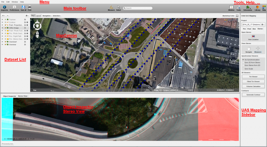
| Orbit GIS Functions | Menu, main toolbar, dataset list, object inspection, mapcanvas. Use full functionality of Orbit software (e.g. add, create new dataset, workspace settings, etc.) |
| Messages & Warnings | |
|---|---|
| New Project Fail | The current workspace doesn't define a projection system. |
| Import Fail | File format error. |
Knowledge Base of Orbit UAS Mapping Software
|
Last modified:: 2019/03/25 11:36
|
