For documentation on the current version, please check Knowledge Base.
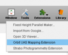
Start Orbit UAS Mapping Software
Orbit UAS mapping software is an extension to Orbit GIS. In other words, all functionalities (such as editing, georeferencing, query builders, etc) of Orbit GIS can be used in the Orbit UAS Mapping Software. For more information on Orbit GIS functions, see here for the complete list of GIS tools and functionalities.
To start Orbit UAS mapping software, you need to have a valid license. Each Orbit product requires a license to operate. Unlicensed copies are illegal and may be subject to presecution. Licenses are obtained by purchasing a product and after installation, supplying your license request to Orbit GT via this website. Upon receipt of payment we forward a license bound to your key. Licenses cannot be transferred. (licensing) To get your license, see licensing for more information.
|
|
|
Demo Data of Orbit UAS Mapping Software
|
Last modified:: 2019/03/25 11:36
|
