For documentation on the current version, please check Knowledge Base.
Clearance Checker
This page describes the Orbit desktop extension “Clearance Checker”.
 Main Toolbar > Extract > Clearance Checker
Concepts
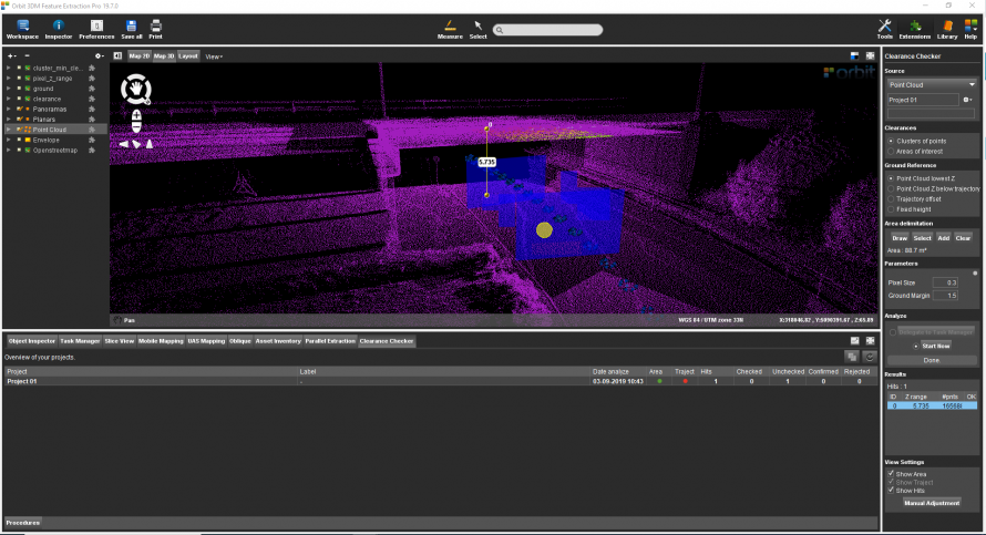
The Clearance checker extension calculates the lowest clearance of overhanging objects or constructions above a surface.
Source
Use the generic workflow for Point Cloud Based Extensions to define the source file.
The method for the range of interest is 'Path', 'Multiple Paths', 'Area' and 'Multiple Areas'.
Supplement, Group By
Select how the clearance obstructions are grouped by:
Clusters - For every area or path, the point cloud gets divided into clusters. For each cluster, the lowest clearance will be calculated.
Ranges - For every area or path, the lowest clearance will be calculated.
Ground Reference
Choose one of the below-described options to define the Ground Reference:
Point Cloud lowest Z - The lowest z-value of the point cloud.
Point Cloud Z below trajectory - The lowest z-value of the first point cloud cluster found below the trajectory.
Trajectory offset - Fixed vertical offset from the trajectory.
A trajectory needs to be defined in block Trajectory: a new path can be drawn or selected.
Vertical offset needs to be defined in parameters.
Fixed height - Fixed z-value defined in parameters.
Use paths - The source path(s) are used to set the ground reference.
Parameters
Generic concepts, see Preferences for Detectors
Some parameters are greyed out based on the options previously selected.
These two options are available for detection by area: range of interest is Areas/Multiple Areas and Group By is Ranges.
Temporal Analysis
Point cloud timestamps are analysed to make sure only points collected in the same run are used to calculate clearance. When a gap of 10 seconds is found, a new time interval is created.
Option to save points from each time interval in a point cloud selection is available in output parameters.
Validate Ground
Two ground validations are done: ground Z value and ground thickness.
- Ground expected value: Calculated ground value per pixel will be compared to expected ground. Expected ground value is Z value from the area (the center of spatial bounds of the area), and a tolerance is used around this value to accept calculated values.
- Ground Thickness: From ground to minimum clearance nothing is expected, so from the minimum Z value of the pixel to the minimum clearance value above that value, the thickness of the points should not exceed Thickness Max.
Each area of interest will have a calculated percentage of valid ground, attribute: Area Pixels Ground Perc.
When temporal analysis is also enabled, this ground validation is done per time interval, allowing us to have a better coverage of the ground of the area. And the percentage of valid ground includes calculations from all time intervals.
Results
The Hit count is the number of clearances found.
- Z range: Value of the clearance.
- #pnts: Number of points defining the ceiling of the clearance.
DEM files are added to the Dataset List by default and are saved in the corresponding folder (see above).
- Clearance
- Cluster_min_clearance
- Ground
- Pixel_z_range
Clearance Checker Tab
In the Clearance Checker Tab all Clearance Projects are shown including the results and metadata. Standard operations like detaching and maximizing tab are available.
