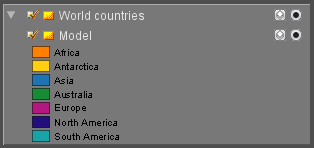
Legend Display
 A map is a reduced representation of the real world, using graphics, colors, symbols and so on.
To ensure the reader understands this representation correctly a map legend display is indispensable. It like a dictionary for map graphics.
Show/Hide Legend Display
Via the dataset list dataset context menu the legend display visibility of the active dataset can be set.
- Show Legend Display
Show/Hide all Legend Displays
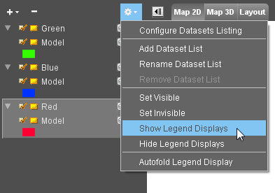
Using the dataset list option menu the legend display visibility of all datasets can be set
- Show Legend Displays
- Hide Legend Displays
Autofold legend display
Via the dataset list option menu the legend display of the active dataset can be made visible automatically at all time :
- Autofold Legend Display
When disabling the autofold option the legend display of the active dataset will remain visible. To hide the legend display use the dataset context menu option, see above.
Create an image from the legend display
It is possible to export the legend display as image, using the "Make Legend Display Image" tool.