Table of Contents
MapCanvas
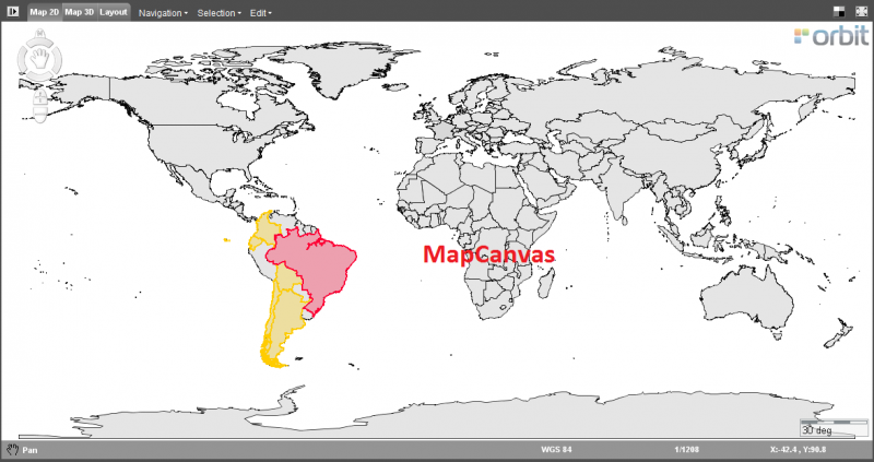
The MapCanvas is the center of Orbit to view and interact with all your resources.
The Orbit desktop has three map views : Map 2D, Map 3D and the Map Layout view. Most products do not have access to the Map 3D as of today.
| Map 2D and Map 3D | |
|---|---|
| Backdrop | The Backdrop icon in the right upper corner toggles the map background color, useful to detect white colored vector objects. On 2D : white, light gray, dark gray, black. On 3D : white, light gray, blue, black. |
| Maximize / Re-size | The Maximize icon in the right upper corner toggles the window between map maximized and split screen mode, according the workspace preferences. |
| Select | Select vector objects or point cloud data on Map 2D and 3D. |
| Context Menu | Right-click on the map to open the context menu and to navigate or export the MapCanvas view |
| Status Bar | Display of active map function, display and edit of map coordinate system and map scale, display and copy of map coordinates. |
| Active map function | The active map function is indicated in the left lower corner of the status bar and by the appearance of the cursor when hovering above the map. |
| Map 2D Only | |
| Map 2D Navigate functions | Compass rose, pan, zoom and rotate functions on Map 2D. |
| Map 2D Measurements | Measure lines, circles, perpendicular distances and angles on Map 2D. |
| Map 2D Menus | Navigation, Selection and Edit menu on Map 2D. |
| Find Objects | Search objects based on a single attribute query. |
| Query Objects | Search objects based on complex attribute queries. |
| Map 3D Only | |
| Map 3D Navigation functions | Navigate, pan, zoom and rotate functions on Map 3D. |
| Map 3D Measurements | Measure points, lines, area and rectangular volumes on Map 3D. |
| Layout | |
| Map Print Layout | Provides all features to make a print of the MapCanvas and make a matching layout. |