Table of Contents
Volumetric Analysis
This page describes how to perform volume calculation on pointcloud data.
This extension is optional and available for : Orbit MM Asset Inventory, Orbit MM Content Manager
 Main Toolbar > Extensions > Volumetric Analysis
Concepts
Volumes
A volume calculation represents a way to quantify a positive or negative feature in comparison with a reference plane, for example the volume of an excavation (cut) or the volume of a depot (fill).
Files & folders
All created files and folders are saved in a new folder <name-of-opc-file>.volumes next to the Orbit Point Cloud file.
Sidebar

Fence
A pointcloud dataset must be available and active in the dataset list.
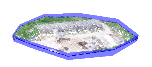
Based on this pointcloud a fence can be drawn around the area for which the volumetric analysis will be applied.
- Draw - start drawing the fence by clicking on the Map Canvas. It is advised to draw on Map 3D in order to better apreciate the Z value of yout fence vertexes. The fence can be edited in Map 2D after it was drawn, by repressing Draw
- Select - select an existing fence
- Stop - finish your fence
- Delete - delete the created fence
Reference
Represents the reference level for starting the calculation.
It can be either a plane based on the pointcloud height or a DEM/TIN if available.
By default, a plane will be automatically calculated based on the lowest point of the fence.
But the height of your reference can be defined also by using Set Plane function and clicking on a desired location on the Map 3D, by entering a number or by adjusting the slider.
Calculate Volumes
Press Calculate Volumes in order to perform the Volumetric Analysis.
This will require some time to complete. The results will be displayed bellow :
- Cut : the volume of areas bellow the reference plane in cubic meters
- Fill : the volume of areas above the reference plane in cubic meters
- Delta : the combined volumes bellow and above the the reference plane
- Sum : the difference between the volume above and the volume bellow the reference plane
Delivery
The results of the analysis can also be exported.
You can choose to export the contours of the fill/cut areas and also the poincloud.
View Settings
Some tools to define the visualization of your selection and results.
- Show fence : enable the visualization of the fence
- Show Reference Plane : enable the visualization of the reference plane
- Show selection : displays only the selected part of the pointcloud
- Result DEM : the display of the resulting DEM can be customized. Threshold : cell size of the created DEM