This is documentation of an archived release.
For documentation on the current version, please check Knowledge Base.
For documentation on the current version, please check Knowledge Base.
Contour Extraction
The raster processing extension comes with a contour extraction utility that's both powerful and fast.
A contour is a line that connects places with the same sample value. This utility finds contours in raster images. Contours can be generated on any image that can be opened by Orbit GIS.
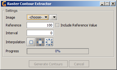
| Image | The image and band to operate on. This must be an opened dataset. |
|---|---|
| Reference | The reference value to start making contours from. |
| Include Reference Value | Treat a sample that equals the reference sample value as inside the contour? |
| Interval | The interval between contours. |
| Interpolation | The interpolation technique to utilize. See below for more information. |
| Progress | Progress indicator of the generator task. |
Interpolation Modes
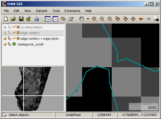
Three interpolation modes are available.
No interpolation
Interpolate edge centers
Interpolate edge centers and joints
Last modified:: 2019/03/25 11:36


