For documentation on the current version, please check Knowledge Base.
The Spatial Information Object
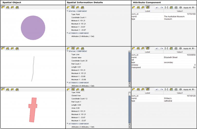
Vector data represents geography as a collection of discrete identifiable units or objects. In Orbit Technology, every single object is considered as an Spatial Information Object or SIO. A Spatial Information Object consists of two components:
- Spatial Component
- Attribute Component
Spatial Component
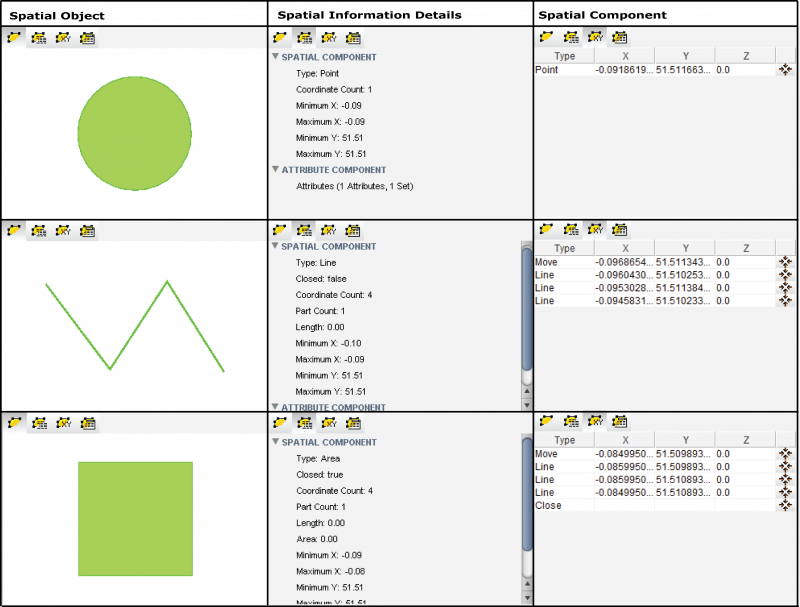
A Spatial Information Object refers to a feature in reality, by considering those features as geometrical shapes. Three types of geometry are distinguished:
- Points
- Lines
- Areas (polygons)
The Object
The Spatial Component of an object is a series of coordinates that together form a figure. In most cases, this is a single figure.
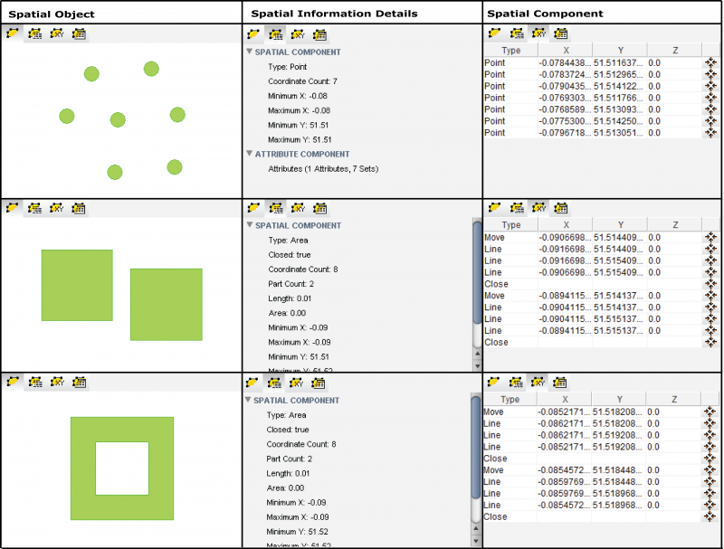
Parts of an Object
This list of coordinates can form more than one figure. These single figures within an object are called Parts. For example an object of type area with 2 parts. The inner part excludes a portion from the outer part, creating a so called donut. An object (Point, Line, Area) can have an unlimited amount of parts, each of from the same Model-type (Point, Line or Area)
Segments
Segments are portions of a part, a pair of coordinates. They do not appear as such in the coordinate list, but are used in some functions to work with a portion of a part rather than the whole part or the object. For example the 'Delete' function exists in all varieties : delete object, delete part, delete segment, remove point.
Attribute Component
The Attribute Component holds the descriptive data in tabular form. This consists out of one or more Attribute Sets (or Attribute Tables) which is the equivalent of a table definition : a range of fields with their datatype definition.
For each Attribute Set, the Attribute Component can hold one or more data rows. Each row contains a value for each field in the Attribute Set.