This is documentation of an archived release.
For documentation on the current version, please check Knowledge Base.
For documentation on the current version, please check Knowledge Base.
http://3dmapping.cloud/about-3dmc/about-viewer-settings
Using the Viewer Settings parameters
Version 19.0.1 of the 3D Mapping Cloud Viewer and SDK provide a number of general Settings that the user can apply during the use of the Viewer.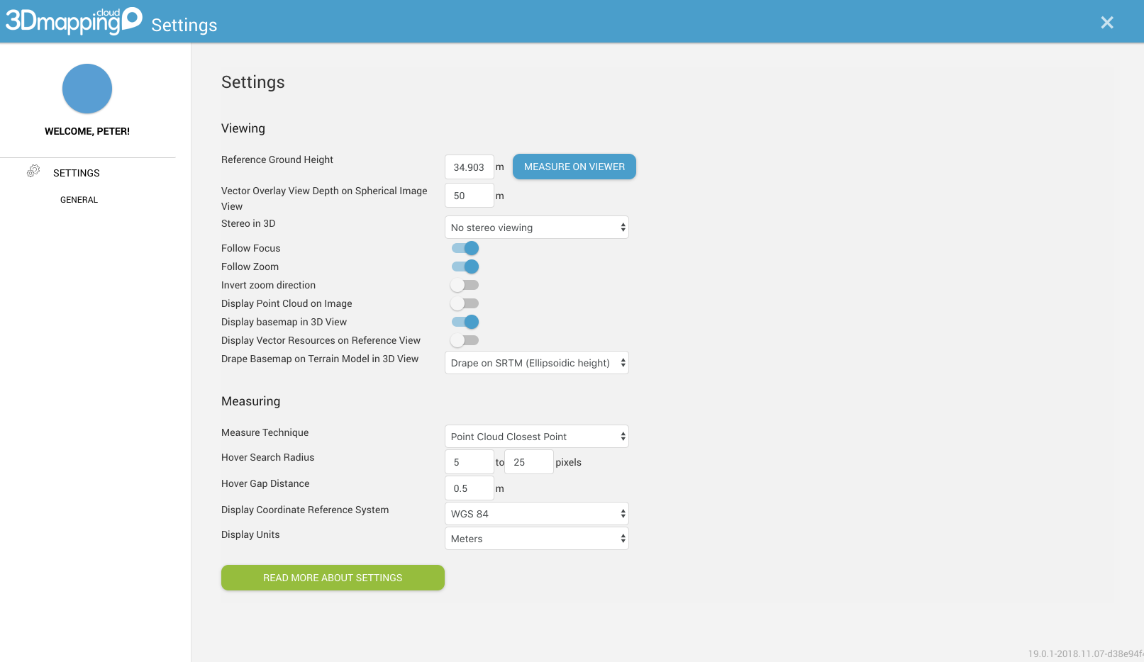
Viewing Settings
Ground Height : the Z-value in your current CRS that is used as reference height. Vector Overlay on Spherical Images : When displaying vector data on a Spherical image, you want to limit the viewing depth. Set the distance here. 3D Stereo Mode : if you want to look in stereo, switch on Stereo Mode in any of the presented options. Note : to view in stereo, you either need the proper anaglyph glasses or according hardware. Follow Focus : Move other Views when panning in one view (applies to select view modes). Follow Zoom : Zoom other views when zooming in one view (applies to select view modes). Invert Zoom Direction : invert the mouse-scroll direction in relation to zooming. Display Point Cloud over Image : when viewing imagery, display the available point cloud over the image so see the combined view. This option is also available from the Resources sidebar. Display Base map in 3D View : when using a base map for your Reference Map view, you can switch this on to show the base map also in your 3D view. The base map will be displayed at Ground Height unless you use a draping method. Display Vector Resources in Reference View : Choose if you want to see your Vector data overlaid on the Reference View. Drape Base Map on Terrain Model in 3D View : If you're viewing the Base Map in a 3D View, you can additionally set to use a height model (DEM) on which the base map will be draped on-the-fly. Current version provides 2 global DEMs. Do not the resolution of these DEMs is quite coarse.Measurement Settings
Measure Technique : The technique to be used in measurements Hover Search Radius : When measuring in point clouds, define a radius to search for points, in order to apply the chosen Measure Technique Hover Gap Distance : minimum distance to separate subsequent pockets of point cloud data Display CRS : The Coordinate Reference System in which measurement results are displayed. Display Unit : The unit in which measurement results are displayed.
Last modified:: 2022/04/15 06:19