For documentation on the current version, please check Knowledge Base.
What's New Version 20.4
Return to the What's New Overview
Highlights April 2020
Simplification and Unification
A lot of attention went to the Measurement Sidebar of the Desktop Products. Today one single sidebar includes the 2D and 3D measurement tools that can be used on any Map, Tab or View. The Asset Inventory Procedure also takes advantage of this improvement.
Layout improvements and unifications spread over the entire interface optimize the standard look and feel.
A list of new features contribute to this unification spread over the entire desktop workflow:
- Tasks can be sent to the Task Manager while its running, including the Colorize Point Cloud procedure.
- The results of the Clash Detection and Clearance checker Extension become available in the dataset list, which allows the user to easily import the results in a Theme.
- The contour lines extensions can now be used on a selected area from the point cloud dataset.
- Semi-Automatic measurements are now possible on the combined point clouds of Mapping Projects.
- Shapes can be created on Map 3D.
- …
The 3DM Viewer used by the Publisher and Cloud software got a major layout optimization. Fewer clicks and a more intelligible interface make the viewer more userfriendly and intuitive to use.
Easy handling of More Data in the 3DM Viewer
Timelines are introduced in the 3DM Viewer that is used by the 3DM Publisher and Cloud. Adding a Time Tag allows Resources to be filtered per view by Time or Time Range. This allows you to better detect changes over time and compare and measure changes.
The Viewer can also handle the use of multiple Base Maps and Dynamic Resources are implemented in the Publisher. This allows the publication, hosting really big resource groups, to load on the fly local resources at the focus coordinate without loading the full resource.
Check what's next
Activate the Beta Functionalities in the desktop products to be ahead of upcoming new features.
3DM Desktop Core
New Features and Enhancements
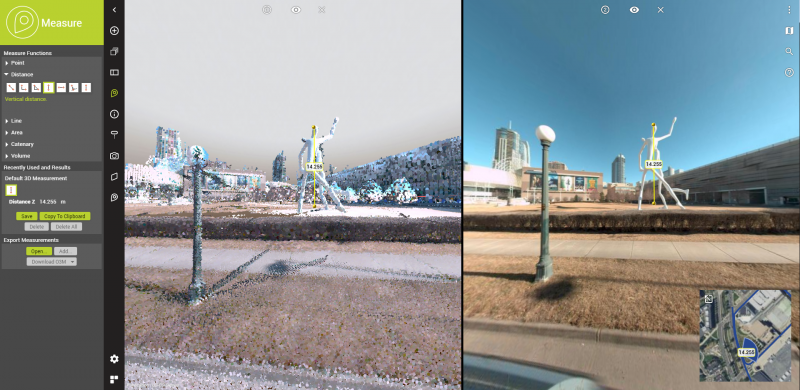
- One single Measure Controller to be used on any Map, Tab or View
This enhancement results in a simplification of the measurement sidebar and asset inventory as well as the ability to use 3D Measurements on Map 2D. - Create a new Database Resource
An Orbit Database file (.odb) can be created from the Dataset List drop-down menu. This will add a table to the configured database. - Export Pointcloud from Slice View
The part of the point cloud available in the Slice View can be exported. At export, the Concert Tool is used which allows the user to choose multiple export options and formats. - Safe multi-part measurement as one or multiple objects
A multiple parts measurement can be saved into individual features or as a single, multiple parts, object. This option is available in the 3D Hover settings and needs to be checked prior to saving the extracted objects. - New 3D Measurement tool “Angle by 3 points”
This tool can be used in Map 2D and 3D and result in the coordinate of the intersection and the angle in degrees. - Create .prj file at converting vector resource to Esri Shape File format
This .prj file accompanies the .shp, .shx, .dbf and Orbit's .ord files. - Activate and list Beta functionalities
They can be activated from the Start-up Preferences. The list is shown when hovering over the text. Modifying the Startup Preferences requires the application to be restarted. - Open Google Maps, Google Earth, Google Earth Pro and OpenStreetMap from the Map Context Menu.
- Re-project Image Data via the Convert Image tool
Source and Target CRS can now be set to convert image data. - Prevent Mapping run to open via drag and drop if a Mapping procedure is open.
A pop-up window asks to close the opened procedure prior to open another run. - Apply Point Cloud View Depth in the Mapping Tab in 3D View mode.
- Set custom blocksize at convert point cloud to .opc
The user can choose a custom block size in the Convert tool next to the options High, Medium and Low density that include hard-coded block sizes. - An improvement on the WFS resource driver got implemented.
Orbit now supports srsName attribute formatted as OGC HTTP URI and OGC URN. - Online resources, that cannot be rendered on Map GL, are excluded on the Zoom Extent and Rendering pipeline.
- The 'number of attachments' Formula is added as an attribute to the Pole Dataset preset configuration.
- Close Dataset is available from the context menu.
Usabilities
- Filtered Context Menu
Dataset actions that cannot be used on Map 3D and Map GL are removed from the Dataset Context Menu of the given Map Views. - Show getting started pop-up window
This pop-up gives you direct access to the what's new list, the full reference documentation, how-to guides and exercises. When the pop-up is disabled at start up, it is available from the upper right help dropdown menu.
Layout
- The rotation point on Map 3D is now indicated with an icon.
- The default size of the Querry Builder got enlarged so all components are displayed.
- The Point Cloud legend panel got improvements on the label display.
- The Convert Point Cloud sidebar UI got updated to be uniform with all convert tools.
Bug fixes
- Returning error messages required a forced application restart at drag and drop of a mapping run that contained an incomplete point cloud .opc resource file.
- Opening an Oblique project didn't set the Map CRS if no resources where visible. The Map CRS was set to 'undefined'.
- It was not possible to select photo positions of Mapping Runs on Map 3D.
- It was not possible to select a Vertical 3D Area having a 2D Area size of 0 on Map 2D.
- Changing the startup language was not applied at the application restart.
- It was not possible to select a line feature that falls completely within the Map 2D Select Area.
- Labels were not visualized in Map 2D - patch for 20.4 released on 2020-04-24.
3DM Content Manager
The 3DM Content Manager includes all 3DM Core improvements.
New Features and Enhancements
- The same Task can not be sent to the Task Manager multiple times.
- Adding a Task while the Task Manager is running is made possible.
- The procedure Colorize Point Cloud can now be executed via the Task Manager.
- The procedures Colorize Point Cloud and adding a mask can now be used with a link.ini file that redirects to the original images.
- The 3DM Cloud Console can be opened from the 3DM Cloud Upload Sidebar.
Layout
- There is an improved label naming in the Ghost Cleaning Sidebar.
'Merge Projects' became 'Prepare for Consolidation'. - The error messages of the Process Data Procedures are reviewed and updated.
- The labels and translations of the 3DM Cloud Upload Sidebar are reviewed.
Bug fixes
- Long Mapping Run names resulted in flashing UI at the Delivery Sidebar.
- Maximizing the Map GL stopped the display of the Textured Mesh.
- Merging and deleting point cloud selections via Ghost Cleaning resulted in temporary point cloud rendering issues.
- Consolidation did not properly take into account the point cloud selections from Ghost Cleaning projects.
3DM Feature Extraction
The 3DM Feature Extraction includes all 3DM Core improvements.
New Features and Enhancements
- Pre-set dataset configuration available for new Asset Inventory Themes
A fixed set of attributes are added when creating a theme. The preset configurations are available for a Dynamic Symbols Dataset, a GPX Dataset and all semi-automated and automated extraction tools. - Results of Clash Detection and Clearance Checker available in Dataset List
Those results can be used by the Asset Inventory procedure for further follow-up or verification. - Set offset from start value for Linear Reference measurements
By adding an attribute 'Offset' to the linear reference vector file, the offset automatically is added to the start value. - Add a fence to the Contour Lines Extension
A Fence allows the user to calculate contour lines within a specific boundary. - Fixed and updated exports of the Profiles & Cross Sections Extension
When choosing the option 'All Sections', individual exports and reports per cross-section along a path become available on a chosen location. The target folder opens automatically after the export has finished. - Semi-Automatic measurements are now possible on the virtually combined point clouds of a Mapping Project.
- Safe rectangular volume measurements
Volume measurement can be saved as features in a Vector dataset or Theme as ribbons into a line vector file or as planes into an area vector dataset. - A default symbol library for Floor Plan Builder is added.
- Measure and Add shapes on Map 3D.
The Shape Creator Extension allows adding shapes created on Map 3D. Before adding a shape was only possible from a Horizontal or a Vertical Slice View.
Usabilities
- Executing the Import Theme Procedure copies the legend file of the source vector resource.
- Selecting a Theme when adding or editing an Inventory Item does not disable the other available themes in the dataset list.
- The Procedure Export Theme can be performed on any Client, not only on the server machine in a Client/Server setup.
Bug fixes
- Correctly zoom to the opened Mapping Extension Project if Geographical Map CRS is used.
Before correct zooming was only applied for projected Map CRS. - The vector resources were not visible in the Floorplan Freeze mode on Map 3D.
- Snapping to all the vertices of a multi-part object was not possible.
- Running the Clearance Checker Extension analysis failed.
- The export and reports for profiles and cross-sections were no longer working.
- The Intensity template extraction did not function properly.
3DM Viewer
The 3DM Viewer includes all 3DM Core improvements.
New Features & Enhancements
- Filter on Time per View
In the setup of a resource or resource group a time tag can be added. This allows the data to be filtered per view by Time or Time Range (day, week, month, year). - Combine multiple base maps on Reference View
From the Settings Panel in the Viewer this option can be switched on and will allow multiple base maps to be selected from the top right Basemap Menu. - A warning pops when opening the 3DM Viewer using an unsupported browser
Internet Explorer and Edge pre Chromium show the error.
Chrome, Edge (Chromium) Firefox or Safari should be used. - 3D Measurements can be downloaded and opened as .o3m format
3D Measurements can be downloaded as .KML, .o3m or .GeoJson. This was in the previous version already possible but o3m had the label WKT. - The 3DM Viewer is now fully supported on Edge (Chromium).
- Warning at open Image View when requested focus coordinate is out of dataset boundary.
A warning will prevent an Image View to open or move when the focus coordinate is outside the resource envelope.
Layout
- A simplified access to Close View is made possible directly from the View Menu.
- The rotation point on the 3D View mode is indicated with an icon.
- The View Action Fly-out is replaced with Icons in the Sidebar Ribbon to be more userfriendly.
- The View ID icon is modified to improve visibility.
Bug fixes
- Point Cloud overlay on image hover setting was set inactive
Issue occurred when the opened workspace or publication contained a resource group of mapping runs including point clouds and if both Spherical Image View and 3D View Mode were used. - The Photo navigation arrows, indicating nearby images with similar orientations, were not visible at opening a workspace or publication.
- Vector labels were not displayed on Reference View.
3DM Publisher
The 3DM Publisher includes the 3DM core and 3DM Viewer improvements.
New Features & Enhancements
- Dynamic resource groups are available
This allows the publication, hosting really big resource groups, to load on the fly local resources at the focus coordinate without loading the full resource. - The Publisher Console can have restricted access by IP
To avoid misuse, the Console can be fixed on a specific IP, set from the System Tab. - From the 3DM Publisher Console - System tab, logging can be enabled.
Bug fixes
- Resource Groups of Mapping Runs missed the Point Cloud legend setting by RGB and Intensity
- The Simplified Trajectory on the Reference View had an incomplete display.
- Publication user logins were case sensitive.
3DM Cloud
The 3DM Cloud includes the 3DM core and 3DM Viewer improvements.
New Features & Enhancements
- There is improved performance and reduced loading time to open Runs, Resource Groups and Dynamic Resource Groups.
Usabilities
- The 3D View Mode Viewer Settings and Workspace options are made unavailable when the 3D View Mode is set inactive.
Bug fixes
- Taking ownership of a Resource Group was not possible.
- Set custom logo as Publication Logo was not saved.
- Publication Guest User logins were case sensitive.
- The resource tag 'Updated by' and the accompanying Date and Tool were incorrect.
Now they are empty as long as the resource is not updated and are correctly filled when the resources gets an update.