For documentation on the current version, please check Knowledge Base.
Slice View
This page describes the use and functionalities of the Slice View tool.
Content Manager, Feature Extraction Basic - Standard - Pro
![]() Map 3D > Tabs > Slice View
Map 3D > Tabs > Slice View
Concepts
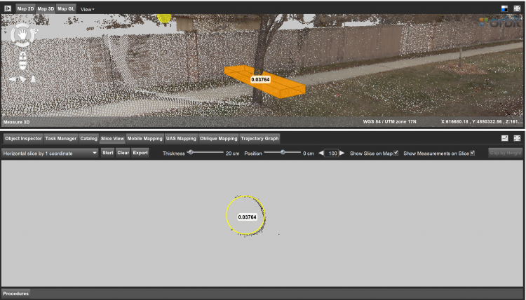
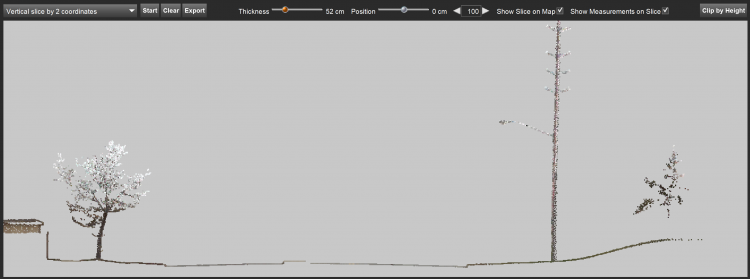
A slice represents a 2D representation of a chosen area from a 3D point cloud based on a defined plane. It can be a horizontal, vertical or user-defined angular plane.
Navigation
Navigation in the Slice Viewer window is similar to navigation in Map 3D, see: Map 3D Navigation functions
Choose slice option
Vertical slice by 2 coordinates: Defines a vertical slice by clicking on 2 points in Map 3D.
Horizontal slice by 1 coordinate: Defines a horizontal plane of the slice by clicking on 1 point in Map 3D.
Free slice with 3 coordinates: Define a slice by clicking on 3 points in Map 3D.
Free slice with 1 coordinate: Define a slice by clicking on 1 point in Map 3D. The slice will be created in the plane as defined by the hover.
Vertical slice perpendicular to reference: Click on 2 points for defining a reference line, then click on 1 point to define the perpendicular slice in Map 3D.
Horizontal slice by 3 coordinates: Defines a horizontal plane of the slice by clicking on three points in Map 3D.
Additional Options
Start: Starts the clicking on points to define the slice.
Clear: Deletes the active slice.
Export: Export the selection of the point cloud shown in the slice view as a new .OPC file. Activating this function opens the Convert Data tool to continue the export there.
Thickness: By adjusting the slider it is possible to modify the thickness of the slice.
Position: By adjusting the slider it is possible to adjust the position of the slice in the 3D Map. The slice can be moved via the arrows and filling in the desired distance (default 100 cm).
Show Slice on Map: Checkbox to show the slice in the Map 3D.
Show measurements on Slice: Checkbox to show the measurements in the slice view.
Clip by Height: Select two points in the slice view to clip the point cloud in Map 3D in between the heights of these two points.
Measure functions
All the measuring functions available in the 3D Measurements can be used in the Slice Viewer.
Results
This tool is useful for making measurements in places where there are no points in the point cloud. For example, to measure the exact center of the trunk of a tree, where no points are available.