For documentation on the current version, please check Knowledge Base.
Create New Vector Dataset
The Orbit Desktop wizard “Create new vector dataset” makes it possible to create a new simple vector dataset and add it directly to the current Workspace.
![]() Dataset List > + > New vector dataset
Dataset List > + > New vector dataset
The wizards has 3 steps :
Dataset

Set dataset file name, display name (optionally), spatial type (point, line, area), coordinate type (2D, 3D), dataset coordinate system and the basic legend parameter.
Once the Dataset is created its Properties, Structure and Legend can be reviewed and modified, see Dataset Properties Window.
The current Map Coordinate System will be set as default Dataset CRS, change if required.
The available basic legend parameter depends the spatial type:
- point : symbol library and symbol name
- line : outline color
- area : fill color
Attributes

Create the Attribute Set by adding Attributes. Set the attribute name, display name (optionally), data type (string, boolean, integer, float) and rule.
- To add an attribute an attribute name must be entered, to remove select the attribute and use the according button.
- Attribute Name must be unique, no restriction on Display Name.
- Once the Dataset has been created its Attribute Component and Rules can be reviewed and modified, see Dataset Structure.
Save
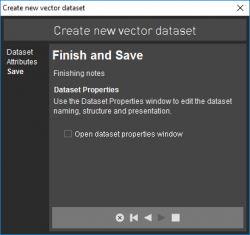
Finish dataset creation.
Open the File Save Window by finishing the wizard (square button). Set file location, name and type (storage format).
- Directly available storage formats are Esri Shape file, Orbit Vector File and Orbit XML file. More information about supported vector resources, see Supported Geodata Resources.
- Once saved, the dataset will be added directly as top layer of the Dataset List.