For documentation on the current version, please check Knowledge Base.
Linear Referencing
Concepts
Linear Referencing (Linear Referencing System or LRS) is a technique of spatial referencing which defines localization of an object in relation to a linear feature, position is measured along a line of interest (Linear Reference WIKI).
Linear Reference Measure Option enables additional Measure Attribute Formula for every measurement, identifying linear distance from the beginning of the closest reference line to the dropped position of the center of the measurement onto this line.
Measure with Linear Reference
3D Hover Preferences
Activate 'Enable Linear Referencing' preference in the “Measure Options” group.
Measure Sidebar
If Linear Referencing is enabled, select 'Linear Referencing dataset' drop-down menu will appear on the Measure Sidebar, where all vector datasets of correct type available in the dataset list will be shown.
Linear Referencing dataset Input
Linear Referencing dataset can either be of spatial type Line or Point. Point datasets should have attribute GPStime (in this case line segments will be defined by 2 consecutive in time points).
Clip Box positioning
With Clip Box positioning slider and 'jumping distance' the clipping box can be easily moved along the linear referencing line if the Clip Box is defined (how to define clipping box, please see Clip).
Results
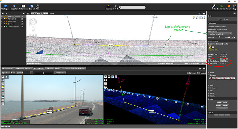
The center of the measurement will be dropped perpendicular to the closest line segment of the reference dataset. If the reference dataset is 2D, closest perpendicular distance will be calculated in 2D. If the reference dataset is 3D, 3D distances will be used.
- The dropped distance is shown as a pink line.
- The Linear Referencing candidate is shown as a green line.
- Linear Ref. measure attributes are shown on the Measure sidebar.
