This is documentation of an archived release.
For documentation on the current version, please check Knowledge Base.
For documentation on the current version, please check Knowledge Base.
Process Point Cloud or Panorama Ortho image
This page describes how to use the desktop mobile mapping administration procedure “Process Ortho Image”.
![]() Procedures > Administration > Mobile Mapping > Process Ortho Image
Procedures > Administration > Mobile Mapping > Process Ortho Image
Concepts
The “Process Ortho Image” procedure allows the Orbit administrator to process a 2D ortho photo. Processing an ortho image is optional. It might be very useful as background reference and for 2D digitizing. There are 2 options of producing orthos:
1. From the point cloud top view 1).
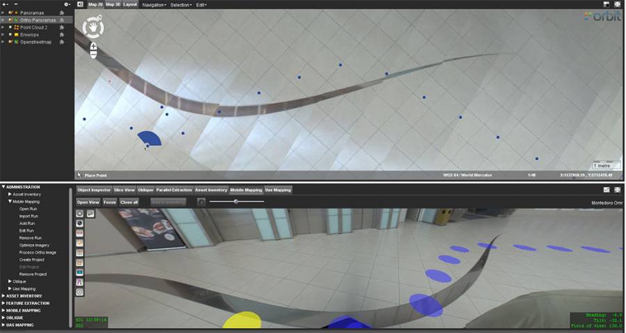
2. From the panoramas. Orthos from panoramas can only be made for the ground/floor area close to the camera positions
Point Cloud Ortho
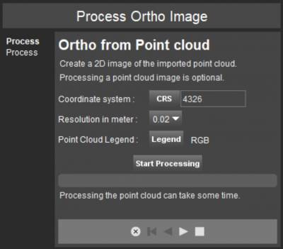
Coordinate system
A point cloud image can be created in any projected coordinate system. Geographical coordinate systems cannot be used as output CRS.
Resolution in meter
The resolution defines the pixel resolution expressed in meters of the point cloud images.
Depending the density of your point cloud the resolution can be adjusted :
- 1 or 2 centimeter resolution for high density point clouds
- 5 or 10 centimeter resolution for low density point clouds
Point Cloud Legend
A legend for the point cloud image can be set.
If RGB and reflection information are available an according image can be created. An image by fix color or height is always possible.
Only one point cloud image can be created for each legend type :
rgb, reflection, height, fix color.
Orbit will replace an existing point cloud image when creating a new point cloud image if one already exits.
Result
The result is an ortho image of the point cloud stored as an Orbit Multiresolution Image within the Orbit Run structure (<Orbit Run directory>\pointcloud_ortho\point_cloud_<legend>.omi).
When the point cloud image has been processed successfully, the Orbit run will be reloaded and the point cloud images will be added to the dataset list.
Legend issue in version 11.1
Fast viewing and point cloud selection on the Map 3D (available from v11.0 in Orbit MM Content Manager) require an updated point cloud legend. Unfortunately this new point cloud legend is not supported by the 2D point cloud ortho image processing tool. The use of the 3D legend on processing the point cloud image will result in an blank image.
This usability issue is fixed in version 11.2. A workaround in version 11.1 is to switch the point cloud legend file before opening the run depending your needs. Download, copy and rename into <Orbit Run directory>\pointcloud\point_cloud.olg
- Fast view and selection on Map 3D : point_cloud_3d.olg
- Point cloud image processing : point_cloud_2d.olg
You can drag and drop an OLG-file on the dataset in the datasetlist in the Orbit Desktop to apply the orbit legend on the fly. The default point_cloud.olg file will not be overwritten.
Examples
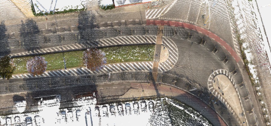
Colorization by RGB
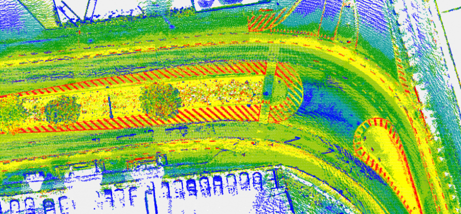
Colorization by Intensity
Panorama Ortho
Coordinate system
Input: input data might be in any projection system (projected or geographical).
Output: 2D orthos can only be produced in a projected coordinate system.
Resolution in meter
Resolution defines ground sample distance of the output in meters. It can be adjusted depending on the quality of the input data.
Radius in meter
Radius defines extensions of the ortho: it is measured from the camera position.

Examples
Mobile mapping
TIMMS
1)
Process Point Cloud Image is possible for all Orbit runs imported from Orbit version 10.5 or later. Orbit runs from Orbit version 10.4 or earlier cannot be used.
Last modified:: 2019/03/25 11:36