This is documentation of an archived release.
For documentation on the current version, please check Knowledge Base.
For documentation on the current version, please check Knowledge Base.
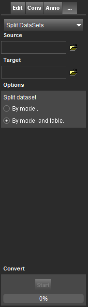
Split DataSets
This page describes the additional tool “Split DataSets”.
![]() Map 2D > Tools 2D and 3D > … > Split DataSets
Map 2D > Tools 2D and 3D > … > Split DataSets
Concepts
Splitting is the GIS operation that consists in breaking a dataset into different output datasets.
Sidebar
Source
Choose the dataset to split.
Target
Chose the storage location for the resulting datasets.
Options
Split dataset by model
Datasets will be split based on the models they have. See: Vector Data Structure
Split dataset by model and table
Datasets will be split according to the models and their Attribute Sets.
Convert
Press “Start” to split the datasets.
Last modified:: 2019/03/25 11:36