This is documentation of an archived release.
For documentation on the current version, please check Knowledge Base.
For documentation on the current version, please check Knowledge Base.

Generate Contours Wizard...
This functions provides the methods to derive contour lines from the DSM/DTM. Selecting this function opens the a wizard with two steps:
- Add breaklines
This step is made to add datasets containing breaklines. Automatically datasets under the folder called 'breaklines' are supposed to contain the necessary breaklines. These datasets can contain polynes as well as area objects.

- Generate Contours
This step will obviously start generating the contourlines using some parameters. The first parameters are (i) Min Height: the lowest Z value in the DSM/DTM and (ii) Max Height: the most high Z value of the DSM/DTM

- Initial Height
This is the height value at which the lowest contour will be generated. This value is expressed in the coördinate system of the DSM.
- Step Size
This is the interval between the desired contours. The moment that you type in the 'Step Size', the next parameter 'Generated Contours' will be immediately calculated. This value is expressed in the coördinate system of the DSM.
- Generated Contours
This figure shows the number of contours that will be calculated using the given parameters above.
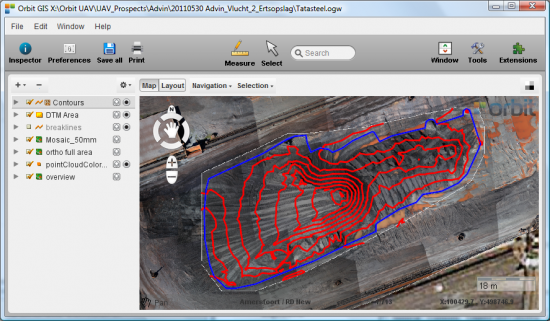
- Generate Contours
Pressing this button will start the generation of the contour lines. As long that the calculation is busy you will see the progress bar moving. A new dataset called 'Contours' will appear in Orbit GIS, on top of the available datasets, showing the final set of contour lines. The followin gimage shows some contours generated and shown in Orbit GIS:
Last modified:: 2019/03/25 11:36