For documentation on the current version, please check Knowledge Base.
Introduction
What is Orbit Strabo X about?
The Strabo portfolio of Orbit covers all aspects of photogrammetric work: manage your data, block adjustments, stereo viewing and softcopy, DEM and ortho-generation, and more. There are 3 modules of this photogrammetric extension to Orbit GIS.
- Orbit Strabo includes the folowing components
(1) The Strabo Project Manager: comiles the technical data and source imagery and prepares all settings. Images are pre-pocessed for optimal performance and rotated views.
(2) Bundle Block Adjustment to process the raw data into fully oriented stereopairs.
(3) GIS integrated stereo viewing to get dynamic and seamless acess to all stereopairs, combineed with any other GIS layer you require in viewing, overlay, interpreting.
(4) Softcopy tools for feature extraction and captation.
(5) DEM maker which allows ou to create DEM's including breaklines resulting in a full TIM model.
(6) OrthoMaker tool for orthorectification and mosaicing.
- Orbit Softcopy is a segment of Orbit Strabo that offers Stereo Viewing and feature extraction. The collected data is saved in Orbit GIS datasets or layers, giving a direct link to GIS content management. Orbit Softcopy starts from an Orbit Strabo prepared project or from an import of pre-triangulated data.
- Orbit StereoView is a segment of Orbit Strabo that offers Stereo Viewing without any data collection functionality, but with which you can panseamless through the project's coverage with superimposition of vector data. Orbit Softcopy starts from an Orbit Strabo prepared project or from an import of pre-triangulated data.
Orbit Strabo, Orbit Softcopy, and Orbit Stereoview are the result of our continuing efforts made in the field of surveying, photogrammetric data production and GIS software development since 1962. Orbit Strabo X represents the update of Strabo 4.4 built on Orbit GIS X. Strabo X is build in Java, using the Orbit Technology Toolkit. The Help files are available in the Help menu.
Where does the name Strabo come from?

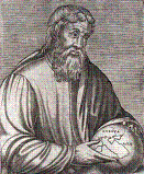
Strabo is a Greek historian, geographer and philosopher who lived from 68 BC until 24 AD. Nowadays, Strabo is mostly famous for his Geographika (“Geography”), a 17-book work containing history and descriptions of people and places all over the world as known to him. Geographica provides a valuable source of information on the ancient world, especially when this information is corroborated by other sources. Within the books of Geographica there is for instance a very interesting map of Europe. (Source: see http://en.wikipedia.org/wiki/Strabo for more detailed information about this interesting person and his work)
