This is documentation of an archived release.
For documentation on the current version, please check Knowledge Base.
For documentation on the current version, please check Knowledge Base.
Orbit Mobile Mapping Publisher Update 10.5 - August 2013
Major Viewer enhancements
- added possibility to define multiple projects, with label and color
- added huge performance improvement for large panoramic imagery
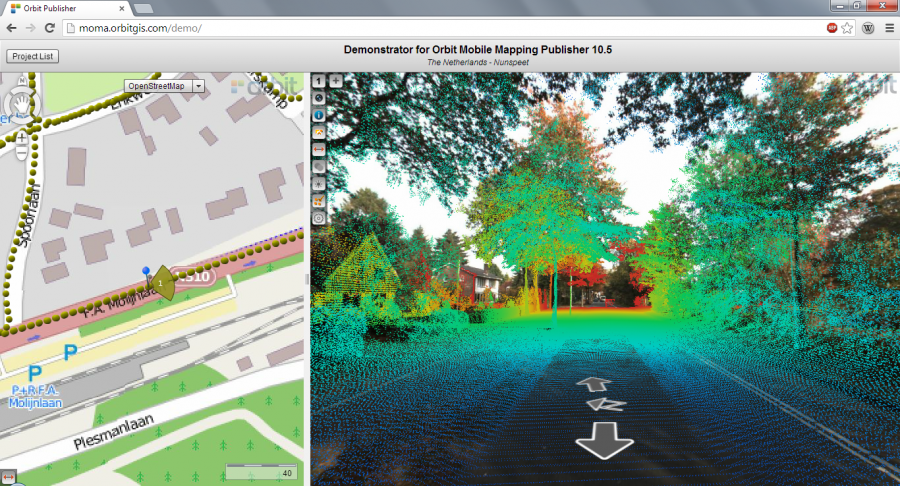
- added visibility of LIDAR data
- added on-the-fly CRS conversion capabilities
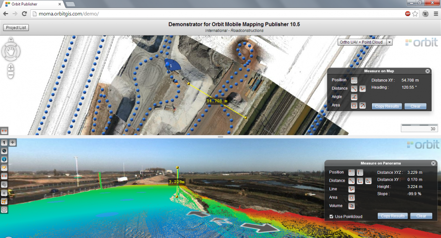
- added Volume measurement
- added configurable search engine / geocoding service integration
- added various measurement capabilities
- added point measurement results display to be displayed in different CRS systems
- added 'slope' values in measurements
- added measurement tools in 2D
- added option to change screen split with tiled panoramas
- added dynamic display of photo positions on the map (below a 1/5000 metric scale).
- added support for high-resolution imagery.
- added option to define publication coordinate system to be used for map display and measurements.
- added panorama snapshot function
- improved values in measurements
- improved HUD for vector overlay control
- extended navigation possiblities
- various bug fixes and enhancements
Major API enhancements
- added API's for controlling widgets and behaviour
- added API to communicate multiple projects
- added API to snapshot, including width/height settings
- added APi to open publication with URL-based command using coordinates
- added API to enable or disable the snapshot button
- Added API to load photo by photo ID
- added API to retrieve the color for photo positions
- added API to retrieve version of the webclient component.
- updated Flex, JavaScript and dotNet API's to 10.5
- implemented new mandatory licensing technique for SDK embedding
- added configuration for panorama search radius
- added configuration for tilt min and max
- added support for running a connection check.
- improved symbol size handling on panorama overlays.
- Check Connection
Method added to check and evaluate a server connection (url / credentials). The method results in a success or failure event and, if applicable the reason why the connection is unsuccessful. - Load Publication Failed Event
The load publication failed event is extended with the reason why the method load publication failed.
Major Server Side enhancements
- improved performance
- added support for Orbit 10.5 large imagery files
- added support for tiled lidar viewing
- improved logging of image consumption for commercial providing services
- possibility to add more html web templates
Updates for Mobile Mapping Viewer
- support for new MM Publisher 10.5 features
- Added About window
- Added Recents list
- Added recently used servers
- Added direct access to demo publications form Orbit demo publisher.
Updates for iOS PanoViewer App
- see updates in App Store when available
Previous updates
Last modified:: 2019/03/25 11:36